Geophysical and geotechnical surveys for offshore wind
Discover the facts on why these investigations are needed for offshore wind.
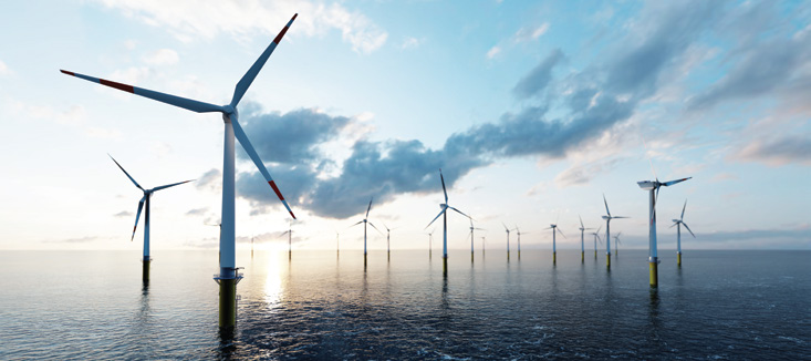
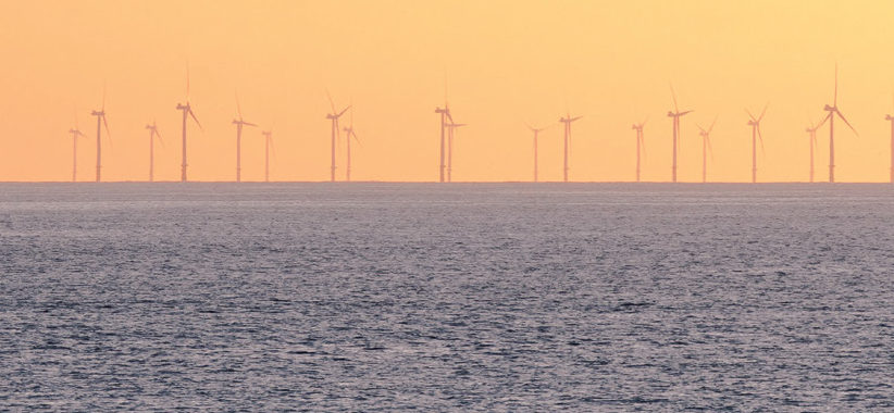
What is offshore wind energy?
Offshore wind energy involves generating electricity from wind turbines in the ocean. These turbines capture wind energy and convert it into electricity, which is then transmitted to the shore via cables under the seabed.
Offshore wind energy has been used around the world since 1991 and increases globally year on year.
Why are both geophysical and geotechnical investigations needed for offshore wind?
Geophysical surveys map the seafloor and the geology beneath it, while geotechnical investigations take physical samples of seabed materials. Offshore wind developers use geophysical and geotechnical investigations to better understand the geology, seabed sediments, and seabed conditions where an offshore wind farm may be located. The information collected helps inform the design, installation, and operation of the proposed development to ensure impacts to the marine environment are minimised.
Are there regulations for offshore wind surveys in Australia and how are these surveys assessed?
Offshore wind surveys must be assessed under the following legislation:
Environment Protection and Biodiversity Conservation Act 1999 (EPBC Act)
Under the EPBC Act, activities that are likely to have a significant impact on Matters of National Environmental
Significance (MNES) require assessment and approval. Developers are responsible for determining whether a proposed offshore wind project will or is likely to have a significant impact on any MNES. Importantly, developers must take into consideration all phases of the development, including surveying.
Navigation Act 2012 and the Marine Safety (Domestic Commercial Vessel) National Law Act 2012.
Under this regulatory regime, offshore wind developers must ensure survey vessels operating within Australian waters promote maritime safety and protection of the marine environment by combatting ship-sourced pollution in the marine environment and providing infrastructure to support safety of navigation.
Offshore Electricity Infrastructure Act 2021 (OEI Act)
Additionally, geotechnical surveys require approved management plans prior to activities commencing under the OEI Act. Management plans must be informed by stakeholder consultation and outline how a licence holder proposes to manage environmental, health and safety, and infrastructure integrity risks.
Applicable state based legislation
Surveys conducted in state waters (i.e. from the coastline to 3 nautical miles/5.55km off the shore) are also subject to relevant state legislation, such as the Marine and Coastal Act 2018 in Victoria, Coastal Management Act 2016 in NSW, and the Western Australian Marine Act 1982 in Western Australia.
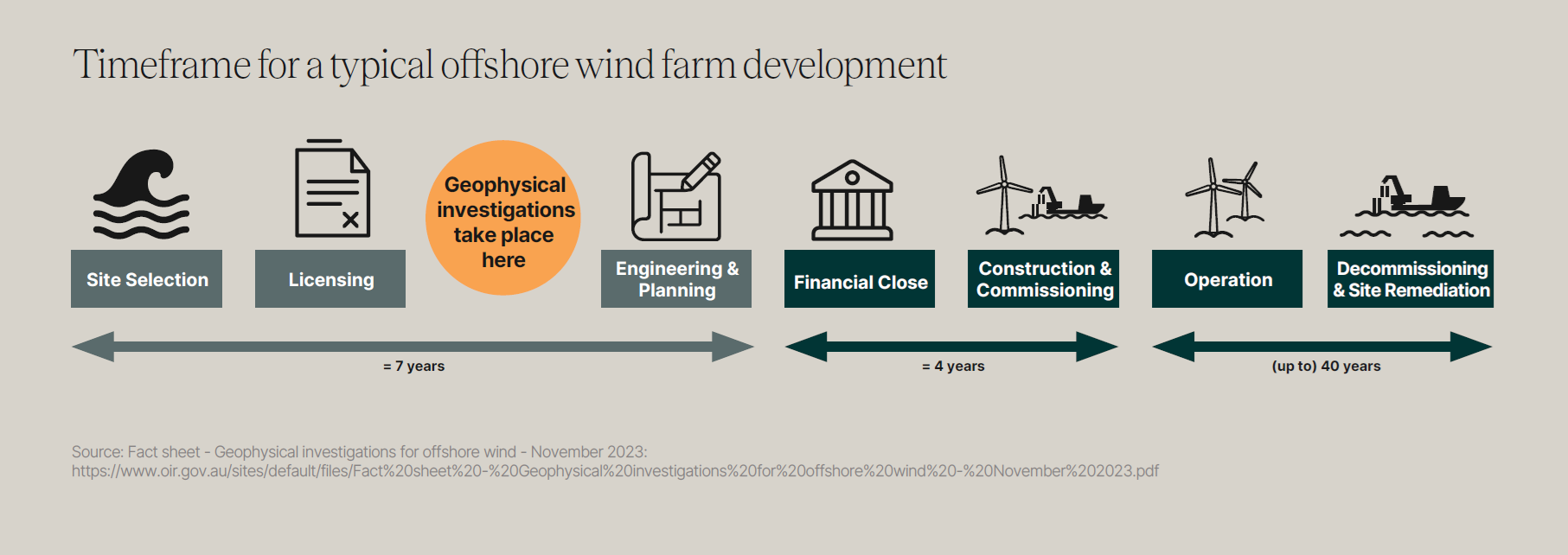
Illustration of activities undertaken for a geophysical survey
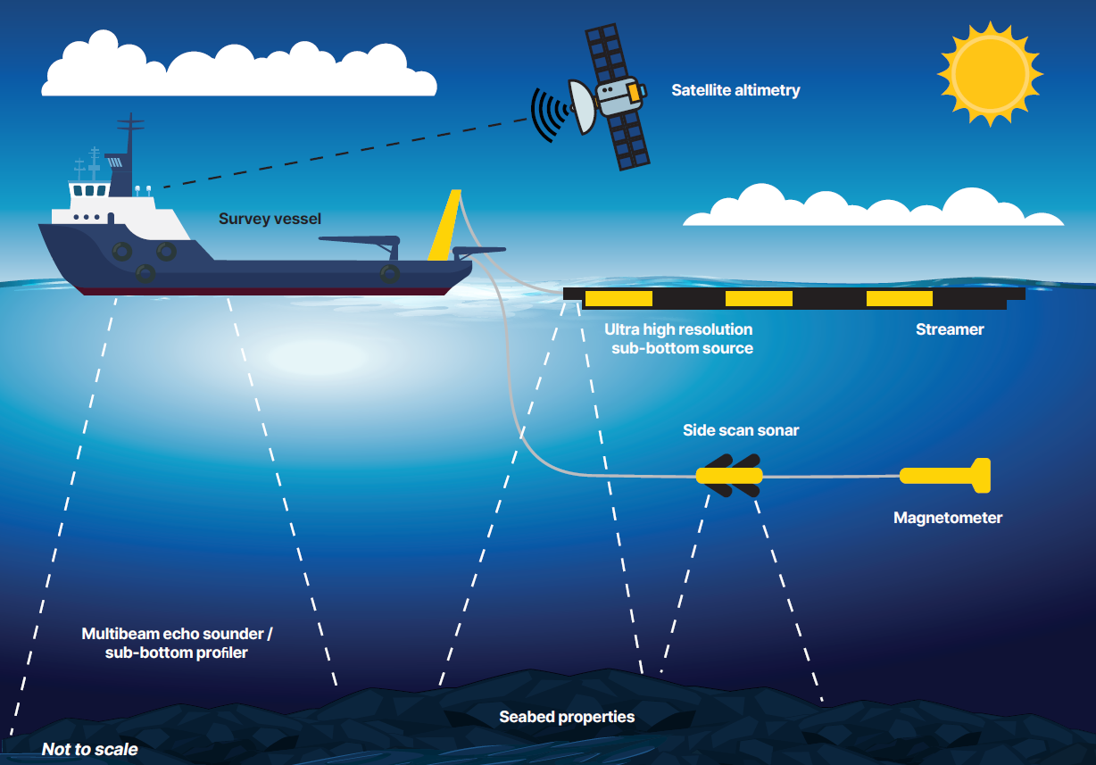
Source: Fact sheet - Geophysical investigations for offshore wind - November 2023:
Geophysical surveys
What are geophysical surveys and how do they work?
Geophysical high-resolution geophysical (HRG) surveys are non-intrusive surveys that map the seafloor and the geology beneath it (<100 m). Vessels carrying out geophysical surveys gather information with a range of sonar equipment, which uses varying frequencies of sound.1
Common equipment used for these surveys include multi-beam echo sounders, sub-bottom profilers, side scan sonar, magnetometers, and underwater cameras to map the seafloor and identify potential hazards or features.2
What is the purpose of geophysical surveys for offshore wind projects?
The data collected during a geophysical survey is crucial for safe and efficient planning of offshore wind infrastructure.3 The information is processed and analysed to create detailed maps and models to better understand the features and composition of the seabed, and any archaeological features, abandoned structures or significant habitat that needs to be considered during the design and construction of an offshore wind farm.
When are geophysical investigations carried out?
Geophysical investigations are typically carried out within the first 1-2 years of a project, during the feasibility licence stage, that is, before any work to build the offshore wind farm begins.
How do geophysical surveys for offshore wind differ from oil and gas seismic surveys?
Geophysical surveys have a lower environmental impact as they use lower-frequency sound to map the shallow geological layers of the seabed, while oil and gas seismic surveys use higher intensity sound that penetrates deep beneath the seafloor.
How are potential impacts to marine life minimised?
Vessels carrying out geophysical and geotechnical surveys must comply with regulations aimed at minimising impacts to the environment and marine life. This includes vessel speed restrictions, observing seasonal migration, breeding and feeding patterns, utilising marine mammal observers and triggering shutdowns if marine mammals are in the area.
Illustration of activities undertaken for a geotechnical survey
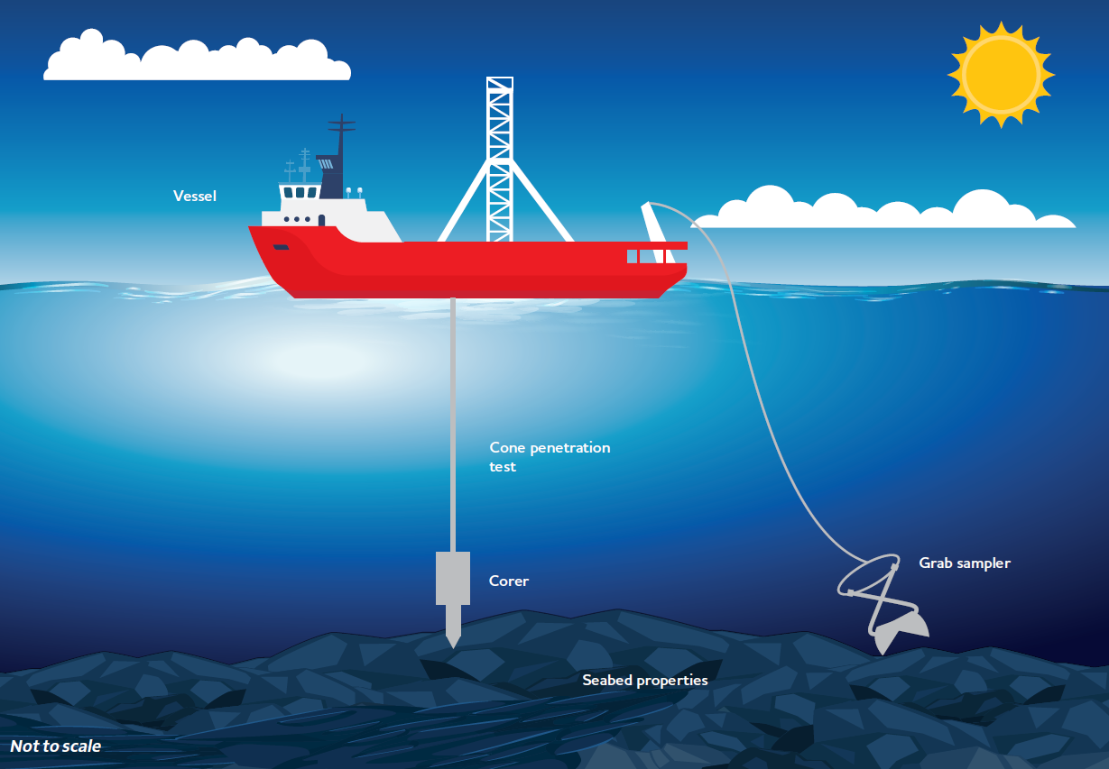
Source: Geotechnical investigations for offshore renewables_Jan24.pdf: https://www.oir.gov.au/sites/default/files/Geotechnical investigations for offshore renewables_Jan24.pdf
Geotechnical surveys
What are geotechnical surveys?
Geotechnical surveys involve physical sampling and testing of the seabed materials, and include activities such as grab, drill and core sampling. Geotechnical surveys assess the physical properties of the seabed and the geology beneath it.4 They inform the technical feasibility of offshore wind projects and help in determining turbine placement and foundation design.
Why are geotechnical surveys important for offshore wind development?
The information collected during a geotechnical investigation is used to understand site suitability and is critical to the design, installation, and operation of the proposed development. These surveys also help minimise project risks, assess ground conditions, determine foundation design options and ensure the stability and longevity of offshore wind structures.5
What challenges are associated with completing geotechnical surveys for offshore wind in Australia?
Challenges include dealing with varying soil types along the coast, potential presence of calcareous sediments (i.e. mostly
or partly composed of calcium carbonate, in other words, containing lime or being chalky), and the need for extensive data analysis. Weather conditions and the remote nature of offshore sites can also pose logistical challenges.6
Is the drilling used in offshore wind geotechnical surveys like drilling oil and gas wells?
Unlike the large-diameter drilling used in oil and gas exploration, geotechnical studies for offshore wind projects use much smaller drill diameters, making the process significantly less invasive.
How do geotechnical surveys contribute to environmental assessments for offshore wind projects?
While primarily focused on technical aspects, geotechnical surveys can provide valuable data for environmental assessments. They help identify sensitive seabed habitats and inform strategies to minimise environmental impacts during construction and operation. Information on the characteristics of the seabed and shallow geological layers also provides an important input to underwater noise modelling. This will improve the accuracy of predictions of noise levels expected to be generated during construction activities.
4 Geotechnical investigations: https://www.starofthesouth.com.au/project-investigations; https://www.oir.gov.au/blog/what-are-geotechnical-investigations-offshore-renewables
5 Geotechnical investigations for offshore renewables_Jan24.pdf (oir.gov.au)
6 Challenges: https://australiangeomechanics.org/meetings/geotechnics-of-wind-energy-onshore-and-offshore/
Top 5 offshore wind facts
Offshore ocean winds are strong and consistent
complementing onshore renewable resources and diversifying Australia's energy mix
Australia has world class offshore wind resources
with wind speeds and ocean depths comparable to Europe's most advanced offshore wind areas
Renewable energy, such as offshore wind, is the most effective tool to protect our marine life from the effects of climate change
The Australian offshore wind industry is already underway
with 25 gigawatts of feasibility licences awarded across 12 projects in the Gippsland offshore wind area, enough to power 13.5 million Australian homes for a year
Offshore wind energy will generate electricity close to where it’s needed
87% of Australians live within 50km of the ocean, requiring less new transmission to be built